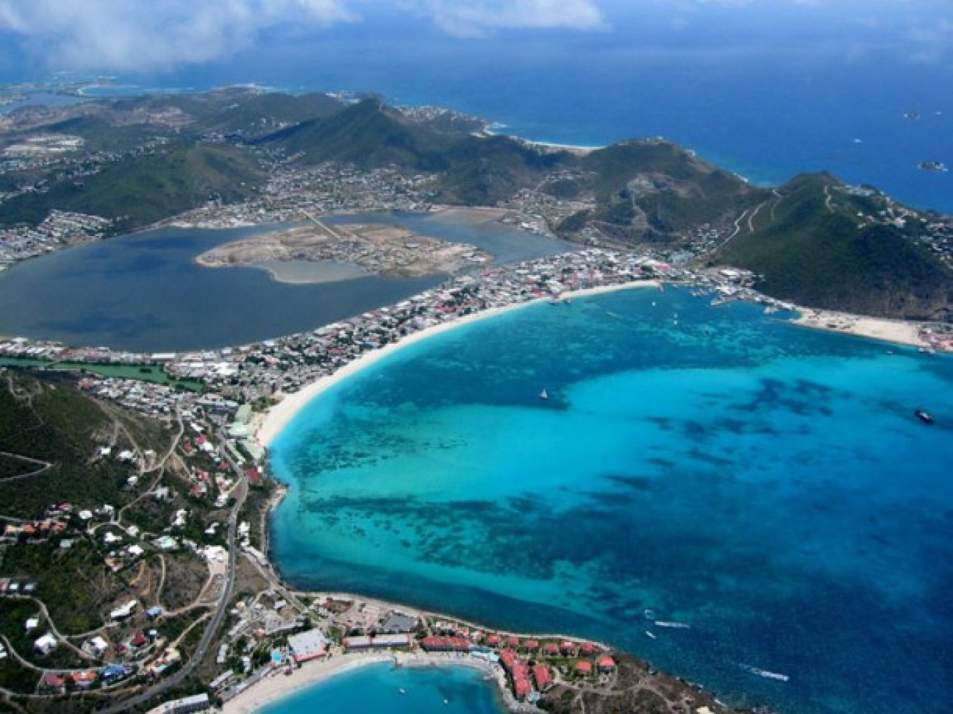
The city of Kuşadası is located within the borders of Aydın Province in Turkey and can be found 71 kilometres to the north west of Aydın’s Centrum. Its distance to Izmir Centrum is measured as approximately 95 kilometres. Kuşadası city by the Aegean Sea is one of the most important touristic centres of Turkey.
The city which covers an area of 264 Km2 has a population of 81 295 according to the figures taken from the 2009 Census.
Kuşadası is thought to have been founded by the Ionians of Neopolis connected to Ephesus in a place called Yılancı Burnu situated close to the city.
Previously, the city was located on the skirts of Pilavtepe in a place called Andızkulesi. After a while the coastal areas which at that time belonged to Byzantines came under the ruling of Venetians and Genoese economically and because of transportation problems was relocated from Andızkulesi to its present location of Yeni İskele (Scala Nuova).
Being named after the city, Kuşadası Gulf and its immediate surroundings (due to having housed so many different civilisations) became widely known as a centre rich in its art and culture.
The area had been ruled by the Lelegler in 3000 BC and by the Aiolians and by the Ions in 11 BC. The area between Büyük Menderes and Gediz Rivers takes its name from the ancient Ionia. The “Ion Colony” is listed as having founded a total of 12 cities in their history.
The Ionians who were Merchant seaman became very rich with overseas trading and had thus gained superior political power. Kuşadası was, in ancient times, the primary port from Anatolia to the Mediterranean and was known by its Neopolis name at that time. The area came under the dominance of the Lydian’s in 7 BC with Sardes as their capital city.
The Persian Empire era began in 546 BC and ended in 334 BC when Büyük İskender took over Anatolia completely. After this, with the Greek civilisation and the local Anatolian civilisation synthesis a new era known as the “Hellenistic Age” commenced and brought with it a completely new understanding in art and culture. The most famous cities of this particular era are Ephesus, Miletus, Priene and Didymia. The area became a religious centre in the first years of Christianity with Virgin Mary and Apostle St. Jean settling in within the area in 200 BC. Miletus became an Episcopal centre of the Christianity era. The area was referred to as “Ania” in the Byzantine Era. The port was used by the pirates in the middle ages and was renamed in 1500’s by the Venetenians and the Genoese to “Scala Nuova”.
In 1086, Süleymanşah let in the State of Seljuk into the region and thus begun the Turkish reign. The caravan routes had also become an export door to the Aegean but the sovereignty of the State of Selcuk was short lived because of the first Crusade and came under the ruling of Byzantines once again soon after. However, in late 1280′s it came under the dominance of Menteşeoğulları, was ruled by the Ottomans between 1397 and1402, went back to Aydınoğulları between 1402 and1425 and again back to the Ottomans in 1425.
In 1413, Kuşadası was joined to the Ottoman Emporium by Mehmet (Çelebi) the first and stayed in the hands of the Turks thereafter and was thereafter filled by art produced by the Turks.
Kuşadası National Park
DİLEK YARIMADASI-BÜYÜK MENDERES DELTA NATIONAL PARK
Dilek Yarımada is shaped by Samsun Mountains’ continuation to the Aegean Sea and its geological structure is made up of Palaeozoic shists, Mesozoic limestones, marble and Neo-gene sedimentary masses. Yarımada has interesting coastal features with its sandy, clayey and high lying beaches.
The sections where lagoons and wetlands are produced on the south of Yarımada at Büyük Menderes Delta (due to the morphological development being faster) has international characteristics and the lagoons where the fresh water mixes with the salty water contain rich biological varieties in its structure. 209 different types of bird species can be found in this rich ecosystem and is not only an extremely important nesting area for the endangered Dalmation Pelican but it is also a safe environment for the pygmy cormarant species. The rarest vegetation of the Mediterranean region (especially in its northern area) is also located in this park. The most vibrant and healthy samples of daphne and chestnut and almost all of the flora maquis of the Mediterranean can be found in this location. It is also the only place where the chestnuts particular to North Anatolian forests and viburms, Junipers, holy oaks and branched cypress trees grows in small clusters. .
The National park is the very last point where those plants and animals under the threat of extinction live. This area has also become a habitation and breeding area for species such as Mediterranean monk seals and sea turtles which are under protection in Mediterranean countries today. The political aimed union of Panionion confederation of the Ionians used the area located on the skirts of Dilek Tepe within the borders of Güzelçamlı immediately to the north east of the National Park as their meeting place in 9-8 BC.


